Escarpment 2026
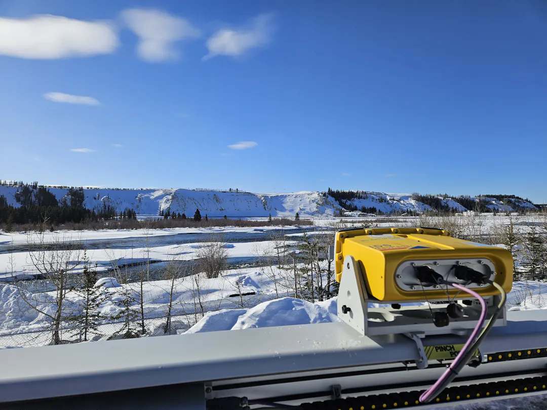
The City is planning for the 2026 freshet season and monitoring the impacts of snow melt on the downtown escarpment, including along Robert Service Way.
There continues to be a risk of landslides along the escarpment and Robert Service Way, as occurred in 2022 and 2023.
There is a potential for Robert Service Way, the Millennium Trail and other trails along the base of the escarpment to experience partial or full closures during the 2026 freshet season if geotechnical engineers recommend closure based on slope conditions. Read the FAQs for more info.
Stay tuned here for updates on the status of the escarpment, and follow our social media channels on Facebook and Instagram for updates.
Please contact the City if you have concerns about the escarpment:
- in emergencies (imminent slope failure or public safety risk): contact the Whitehorse Fire Department by calling 911;
- after hours (non-emergency): call the City reporting line at 867-667-2111; and/or
- for questions and general slope observations, contact City of Whitehorse staff using Report a Problem on our website
Find out how to prepare your household for an emergency at whitehorse.ca/emergency.
-
Escarpment Update #4
Share Escarpment Update #4 on Facebook Share Escarpment Update #4 on X (formerly Twitter) Share Escarpment Update #4 on Linkedin Email Escarpment Update #4 link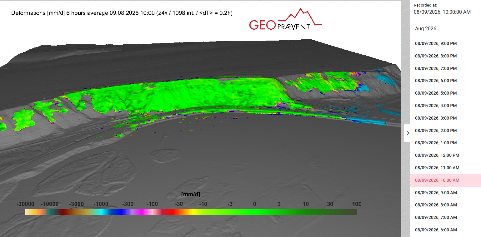
With recent slides closing the South Klondike Highway, it seemed like a good time to provide one last seasonal update on the escarpment in Whitehorse.
Activity along the escarpment has been minimal in recent weeks. Recent rainfall has not significantly increased water seepage or triggered movement, and the latest geotechnical inspections indicate the risk of slide activity remains low.
The City will continue to monitor conditions, but the slope scanner was turned off this week, and monitoring activities will be scaled back appropriately.
The recent helicopter survey captured mass movements and changes in topography observed in the 2026 monitoring season. Lidar data is currently being processed by geohazard experts. All the data collected this year will inform planning for next year's monitoring and risk management program.
Enjoy one last green blob for 2026!
-
Trail Update
Share Trail Update on Facebook Share Trail Update on X (formerly Twitter) Share Trail Update on Linkedin Email Trail Update link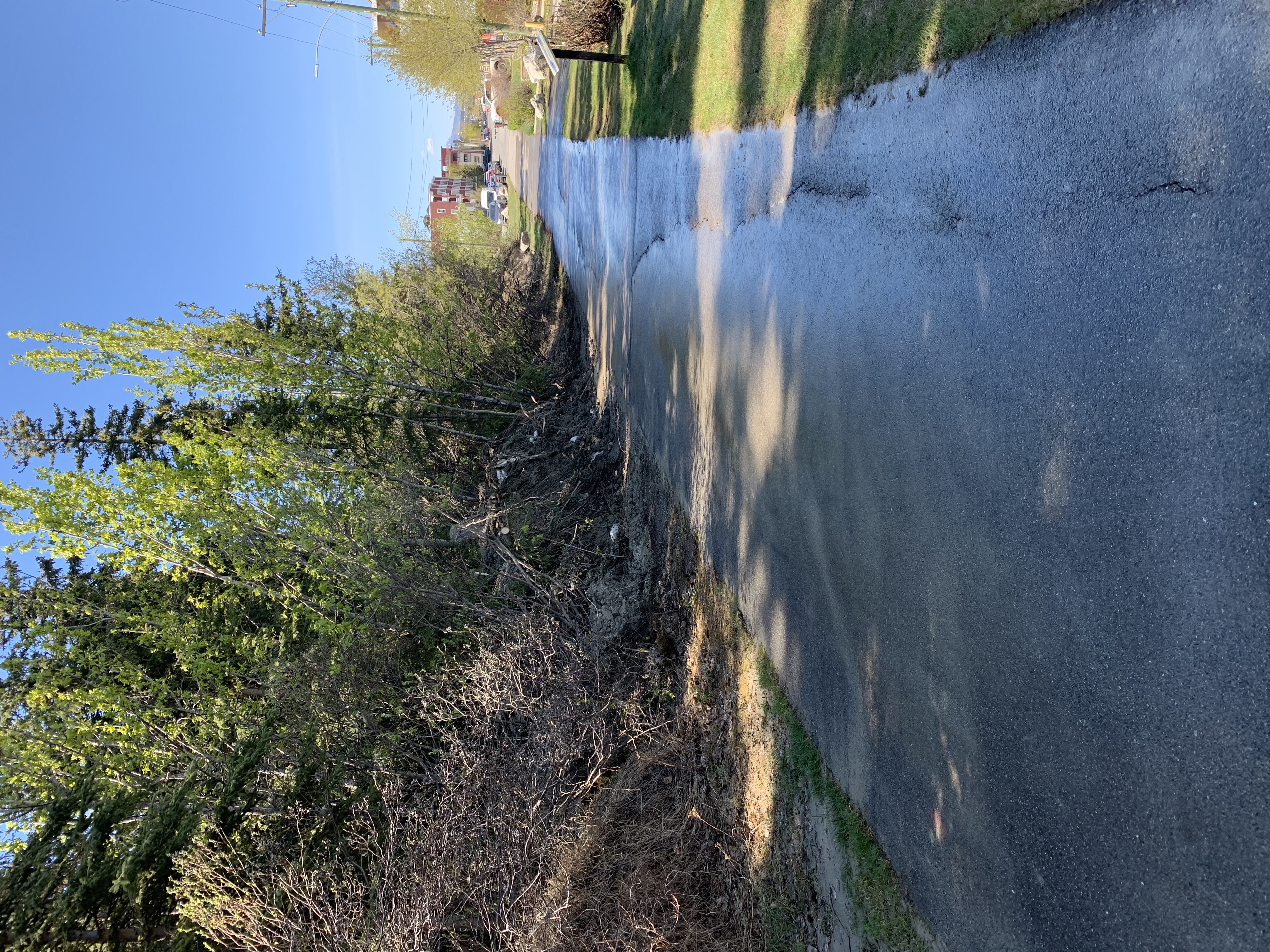
Sections of the downtown escarpment trail between Hanson Street and Lambert Street and between Wood Street and Black Street are reopened.
Following engineering assessments, these sections of trail have been deemed safe for public use, and crews have cleared debris from the minor slides that occurred in late April.
We are still in the freshet season and there continues to be a risk of activity along the downtown escarpment.
Officials are monitoring conditions closely and will continue to take action as necessary to minimize the risk to public safety. This could involve closing additional trails or limiting access to areasContinue reading
-
Escarpment Update #2
Share Escarpment Update #2 on Facebook Share Escarpment Update #2 on X (formerly Twitter) Share Escarpment Update #2 on Linkedin Email Escarpment Update #2 linkThe City continues to conduct geotechnical monitoring and inspection work across the escarpment this spring. Conditions are presently stable with low amounts of seepage along Robert Service Way and Downtown segments of the slope.
We will continue to monitor the escarpment regularly in the coming weeks and will be ready to respond if conditions change. Please continue to respect the current trail closures in place while trail crews begin to prepare selected trail segments for re-opening.
If you observe any concerning escarpment conditions, please contact the Trouble Line at 867-667-2111.
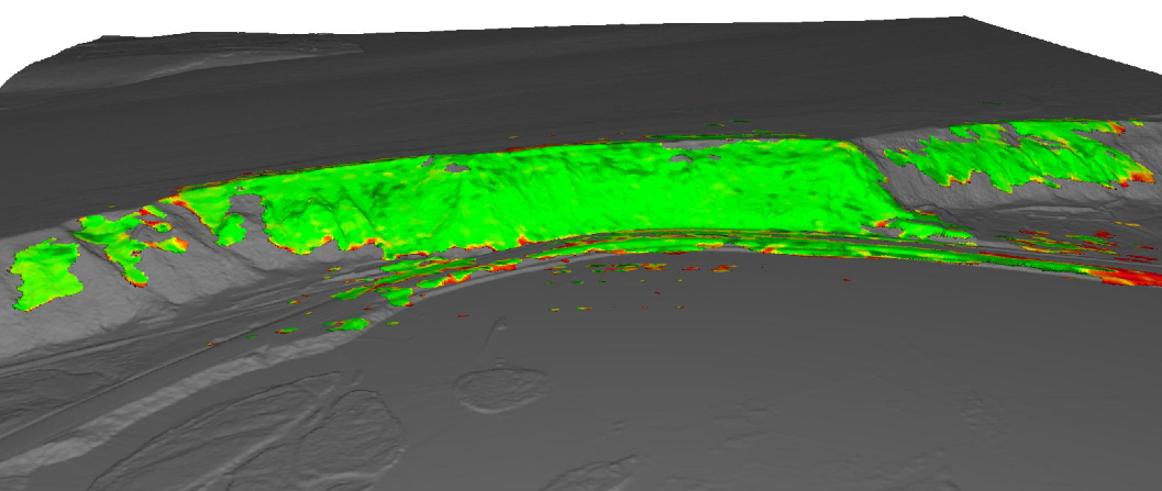
(Scan from May 21)
-
Your questions about snow storage
Share Your questions about snow storage on Facebook Share Your questions about snow storage on X (formerly Twitter) Share Your questions about snow storage on Linkedin Email Your questions about snow storage link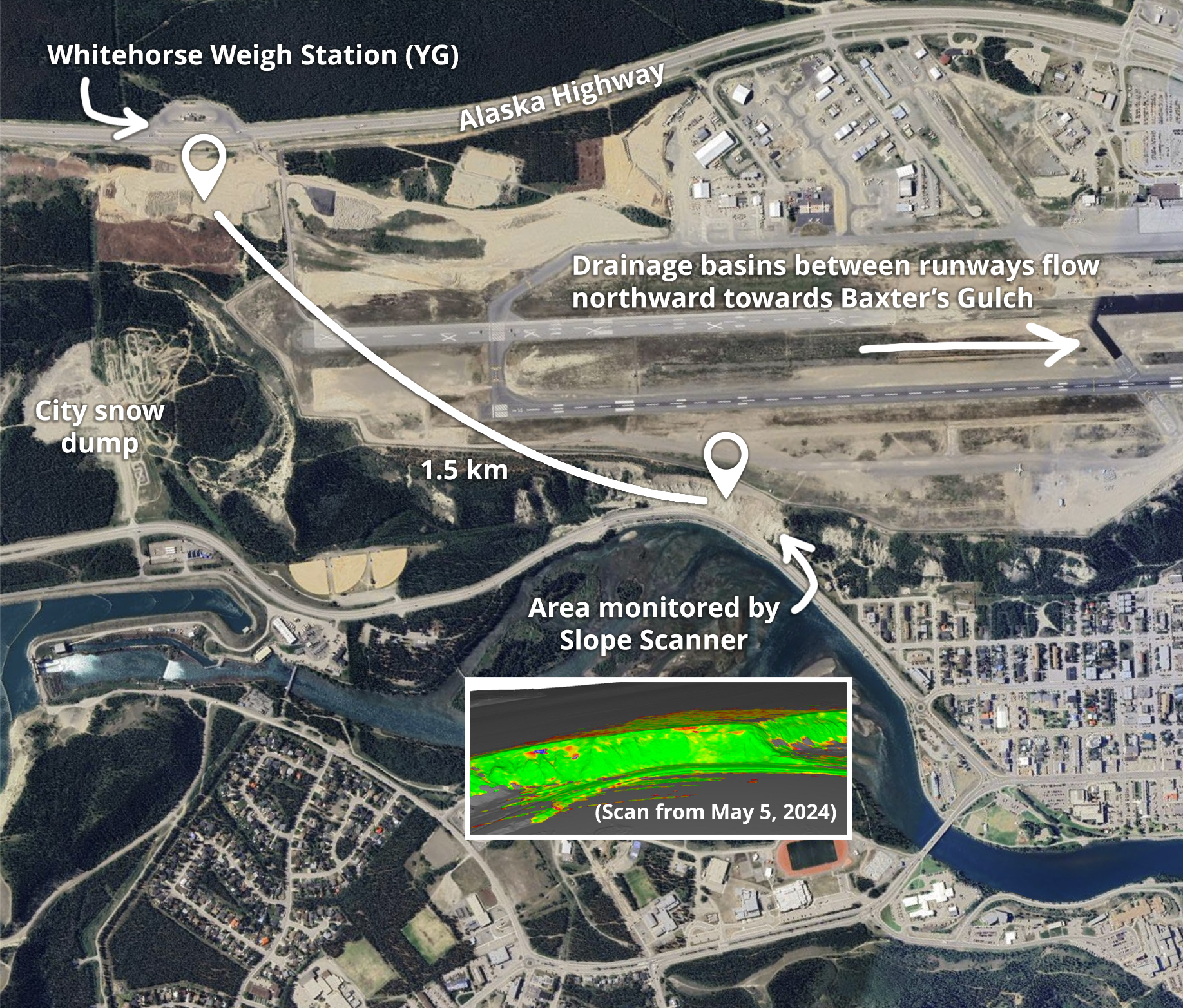
This spring, we’ve seen questions about the parcel of land by the Whitehorse Weigh Station and the snow stored there this winter. This is a Government of Yukon project and is situated 1.5 km from the slope above Robert Service Way.
You’ve also asked about snow at the Erik Nielsen Whitehorse International Airport. The airport is under the jurisdiction of the Government of Yukon. The Department of Yukon Highways and Public Works hauls snow to three different spots far away from the escarpment:
• the area across from the Whitehorse Scales,
• behind the Yukon Transportation Museum, and
• in the northwest corner of the infield, near the highway.During the runway reconstruction, aging drainage systems were replaced with climate-resilient infrastructure, including 11,000 metres of storm drainage pipe to protect the runway surface from groundwater and precipitation impacts.
Drainage basins installed between runways at the airport carry rain and snowmelt towards Baxter’s Gulch, at the north end of the airport. This gulch is 2 km from Robert Service Way.
We’ve included an example of a scan from 2024 to show what is being captured by our Slope Scanner. Regular geotechnical engineering inspections are taking place along the escarpment well past Baxter St, where Two Mile Hill Road meets 2nd Avenue.
You can find more FAQs here.
-
Escarpment update #1
Share Escarpment update #1 on Facebook Share Escarpment update #1 on X (formerly Twitter) Share Escarpment update #1 on Linkedin Email Escarpment update #1 link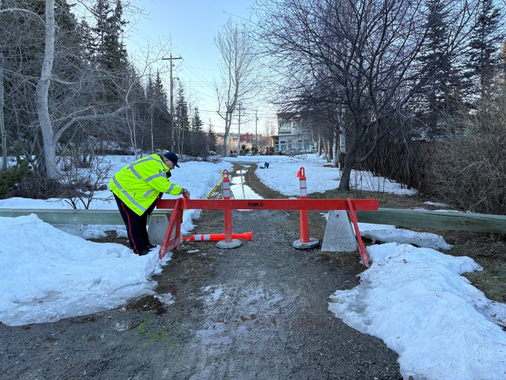
A small slide occurred along the escarpment between Hanson Street and Hawkins Street on April 25.
The slide contained less than 25 cubic metres of topsoil, vegetation and some trees, and slid onto the lower escarpment trail. The trail in the area has been closed until further notice.
Rapid snow melt over the weekend caused mudflow in several areas with excess stormwater flow seen in ponds near the lower escarpment trail between Steele and Main Street.
Sections of the trail between Wood Street and Black Street are also closed as a precautionary measure.
Residents are advised to avoid closed trails and watch for signage in the area.
There has been some debris coming down off the Robert Service Way slope, as well as mud flow. This type of shallow erosion is normal for this time of year and is not a cause for concern.
There continues to be a lot of melt along the escarpment causing some mudflow in several areas. Officials are monitoring conditions closely and will continue to take action as necessary to minimize the risk to public safety. This could involve closing additional trails or limiting access to areas along the base of the escarpment.
The City will continue to respond to conditions and provide updates as necessary.
Contact the City's Trouble Line at 867-667-2111 to report any additional movement along the escarpment.
-
Airport Area Trail Closures
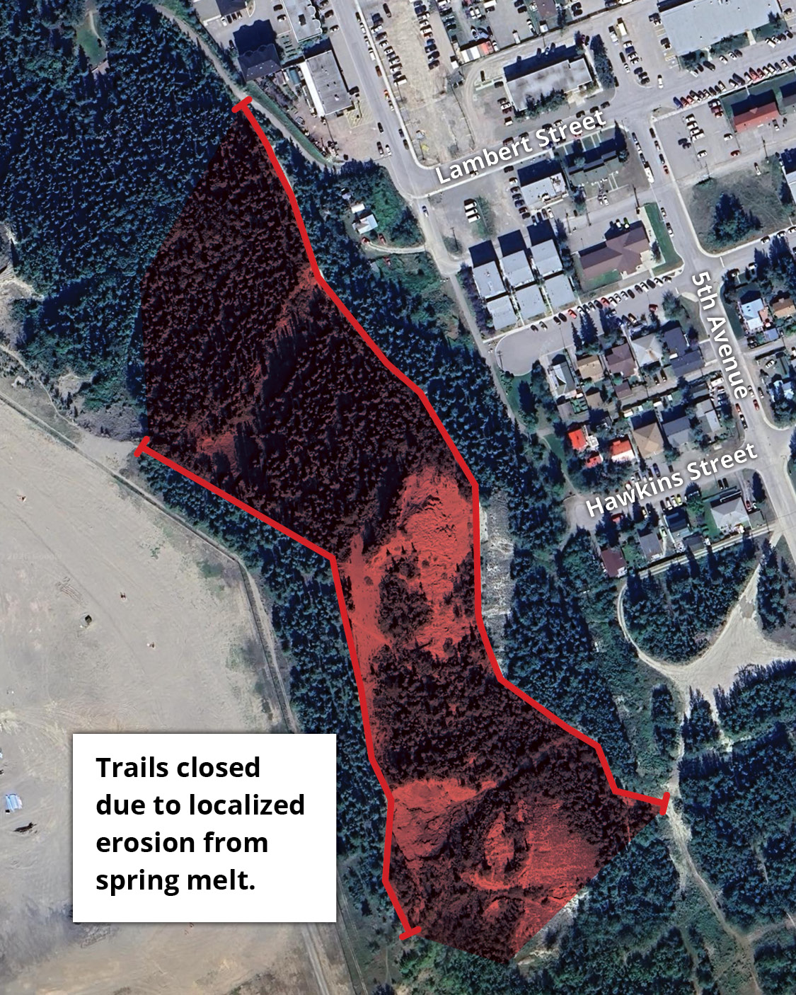
Share Airport Area Trail Closures on Facebook Share Airport Area Trail Closures on X (formerly Twitter) Share Airport Area Trail Closures on Linkedin Email Airport Area Trail Closures linkAs part of the City’s ongoing monitoring of the escarpment during spring freshet, sections of the East Airport Access Road Trail have been temporarily closed. This includes small connector trails within the area shown on the map.
Spring snow melt is causing localized erosion in the area. The City made the decision to close trails to keep trail users safe. The Black Street stairs remain open.
Active monitoring of the escarpment includes the use of a slope scanner, regular engineering inspections, drone surveys and other measures to ensure water seepage and potential slides can be managed in a way that prioritizes public safety and infrastructure.
Changes in trail status and traffic flow may be altered as monitoring continues.
We thank the public for their cooperation.
-
City prepares for increased escarpment risk
Share City prepares for increased escarpment risk on Facebook Share City prepares for increased escarpment risk on X (formerly Twitter) Share City prepares for increased escarpment risk on Linkedin Email City prepares for increased escarpment risk linkThe City is taking steps to manage the impacts of snow melt on the downtown escarpment, including along Robert Service Way.
With record snow fall this past winter, there is an increased risk of landslides during the freshet season.
The City is actively monitoring the escarpment and has enhanced its monitoring program for 2026.
In late March, geotechnical engineering inspections began along the escarpment and the City’s slope scanner was re-installed and activated.
New GPS sensors have been installed in key areas along the escarpment to help detect movement.
In addition, the City is working with technical experts to conduct regular engineering inspections, drone surveys and other survey methods to monitor the escarpment in way that prioritizes public safety.
The City has also installed new traffic control gates south of the roundabout at 4th Avenue and Robert Service Way and between the Millennium Trail parking area and the entrance to the Robert Service Campground.
The gates will be used to block vehicle access if there is a high risk of a landslide or in the event of an emergency to protect the safety of residents.
Residents living downtown in the high and moderate risk zones along the escarpment and those commuting or recreating in the area should be aware of the increased risk of landslides and make a plan in the event of activity in the area.
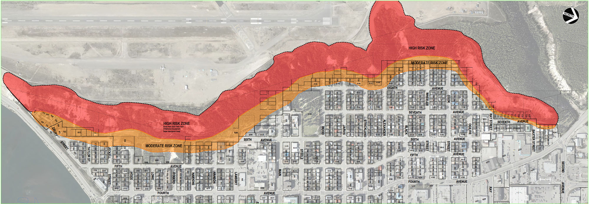
Find info about how to prepare yourself for an emergency at whitehorse.ca/emergency.
