Traffic Calming and Speed Limit Reduction
Whitehorse is a community that values healthy and safe mobility for all, regardless of how we move. The City recently adopted a new Transportation Master Plan, which establishes a long-term vision for transportation in Whitehorse, and a target to eliminate fatalities and serious injuries from Whitehorse’s transportation network by 2040.The City and its partners are committed to this goal, and traffic calming measures and speed limit reductions are among the tools being used to achieve it.
What is Traffic Calming?
Traffic calming uses engineering solutions and urban design to slow vehicle speeds, reduce traffic volumes, and enhance safety forContinue reading
-
2026 Neighbourhood Traffic Calming Plan
Share 2026 Neighbourhood Traffic Calming Plan on Facebook Share 2026 Neighbourhood Traffic Calming Plan on Twitter Share 2026 Neighbourhood Traffic Calming Plan on Linkedin Email 2026 Neighbourhood Traffic Calming Plan linkThe 2026 locations were identified by analyzing areas of concern highlighted in the Transportation Master Plan, the Speed Limit Reduction Report and by residents. Speed and traffic data were collected to validate these concerns and to help determine the most appropriate calming measures for each location.
YEAR-ROUND MEASURES
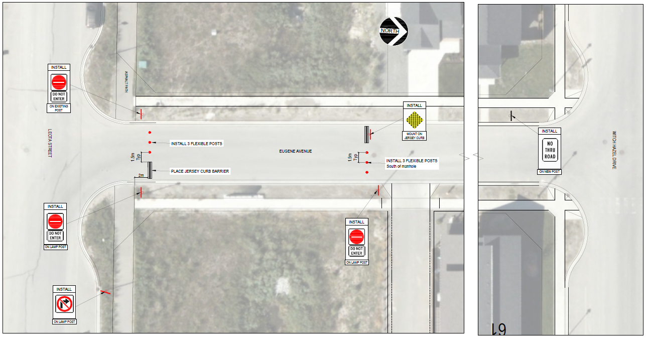
Eugene Avenue South End Closure
Eugene Avenue is a local road in Whistle Bend. Local roads are designed to allow residents to access their homes with minimal through traffic. Due to the roadway design of Whistle Bend, many drivers shortcut through Eugene Avenue, causing discomfort and safety concerns for residents. The City is expecting the closure to take place in early June and remain in place year-round.
- Engineering assessments and public engagement were completed in 2024 to develop a traffic calming plan for Eugene Avenue. The final report is available here. The recommendation is to implement a cul-de-sac at the south end of Eugene Avenue.
- The City temporary closure was piloted for 2 months last summer.
- The design includes knock-down bollards for emergency access and jersey barriers.
- Data collection is ongoing for Leota Street and Witch Hazel Drive.
Pedestrian crossing refuges
These projects include the installation of traffic-calming (TC) curbs at crosswalks, achieving three goals:
- Narrowing the roadway to reduce driver speeds
- Providing a safe refuge for pedestrians crossing one direction of traffic at a time
- Creating space for additional signage
Range Road
Two TC curbs will be installed at the crossings at Falaise Road and Rhine Way.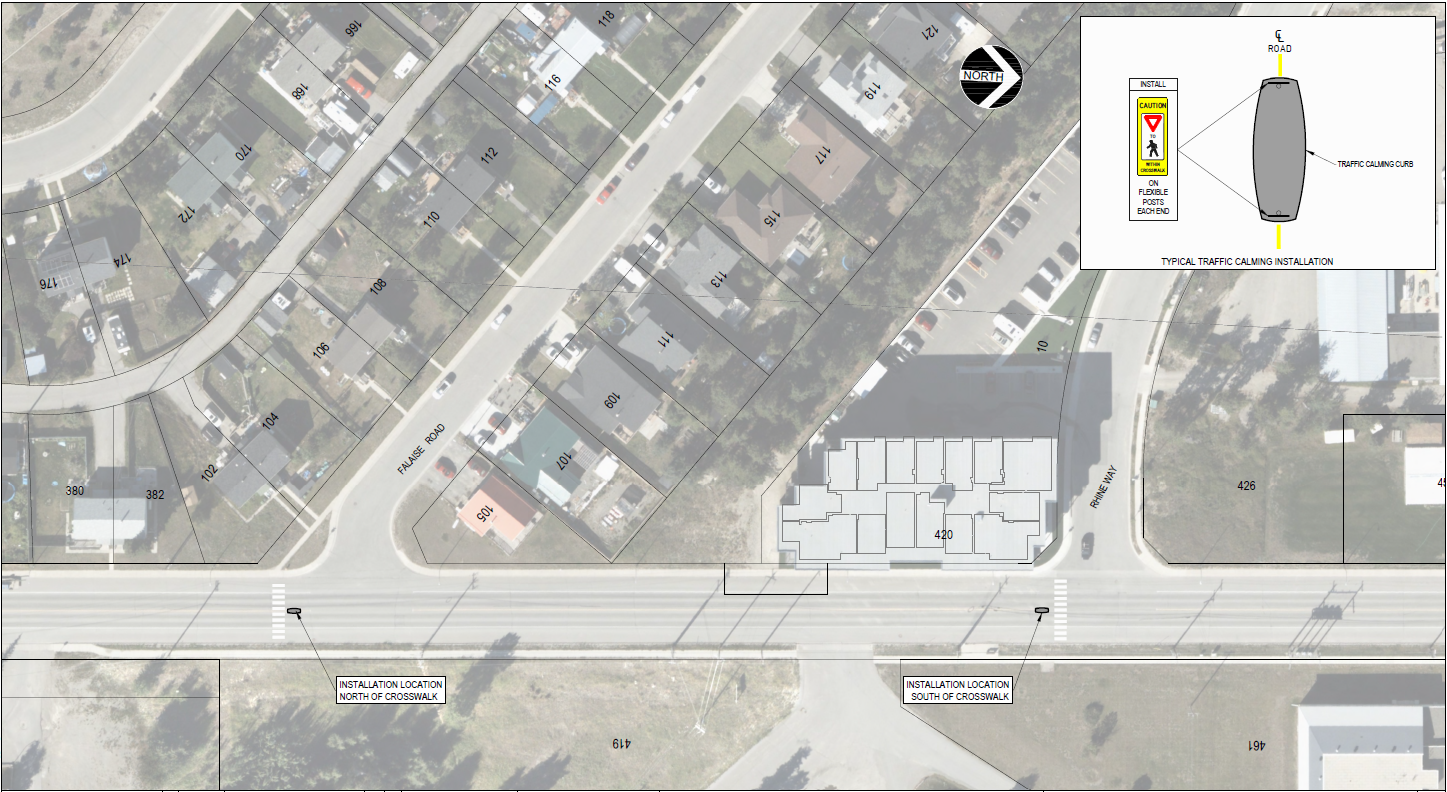
Nisutlin Drive and Alsek Road
Three TC curbs will be installed at the crossings along Nisutlin Drive and Alsek Road.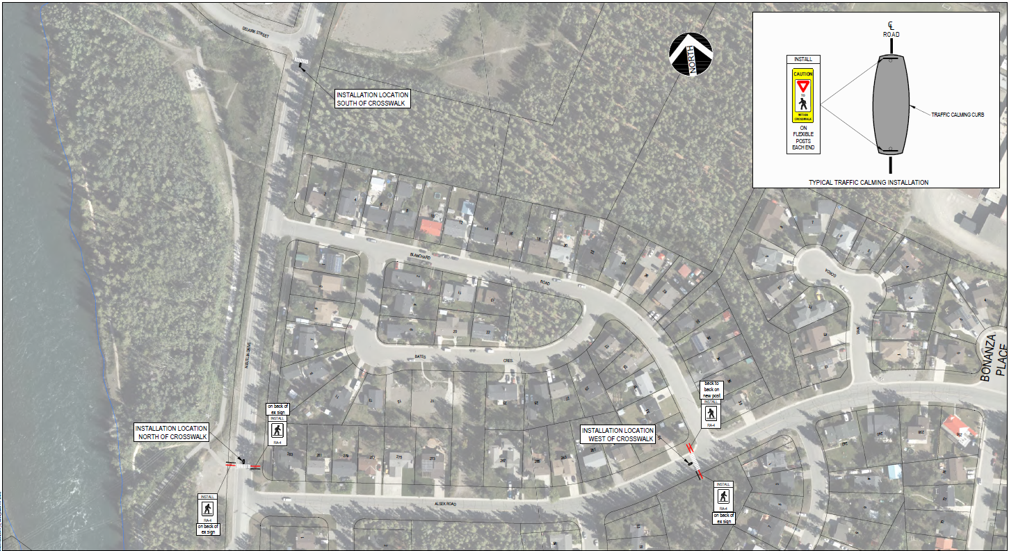
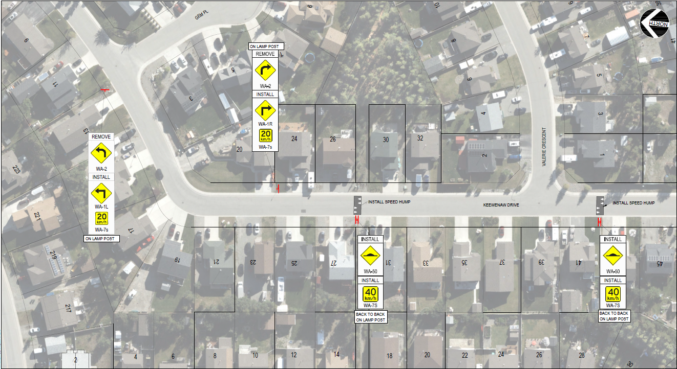
Speed Humps
Speed humps are permanent raised features that encourage drivers to reduce speed. The design used by the City is based on a 40 km/h speed and does not impede snow clearing.
Keewenaw Drive
Klondike Road
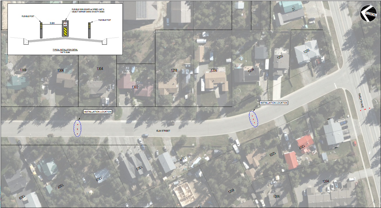
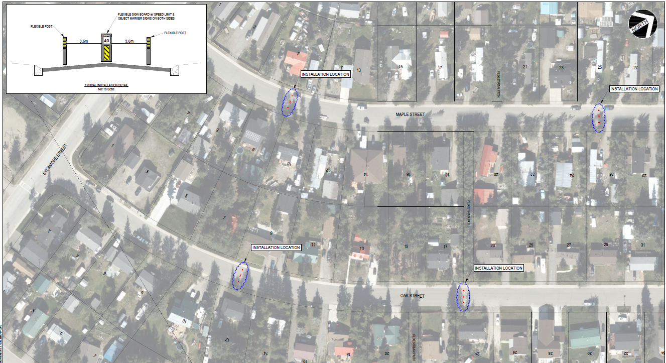
 Please note that the speed humps planned for Elm, Maple, and Oak were not installed last year due to contractor availability. During preparation of this year’s plan, these locations did not rank as highly under the new warrant evaluation. Current budget constraints do not allow for additional installations; however, seasonal measures will be implemented (see below).
Speed feedback signs
The City now has four speed feedback signs that can be deployed throughout the community. These signs are rotated between locations regularly, as their effectiveness can diminish over time when drivers become familiar with them. In addition to displaying vehicle speeds to encourage slower driving, the signs are also capable of collecting traffic data. However, they do not record any information that could be used for enforcement purposes.
Some locations includes Hillcrest Dr, Leota St, Witch Hazel Dr, Sycamore St and Mt Sima Road.
Country residential neighbourhoods improvements
Transverse lines and painted “SLOW” markings will be added to encourage drivers to reduce speed in playground zones in country residential areas. The Transportation Association of Canada notes that this technique can reduce 85th percentile speeds by 5–15 km/h. Two new playground zone are added this summer at Harvey Rd and Salmon Trail.
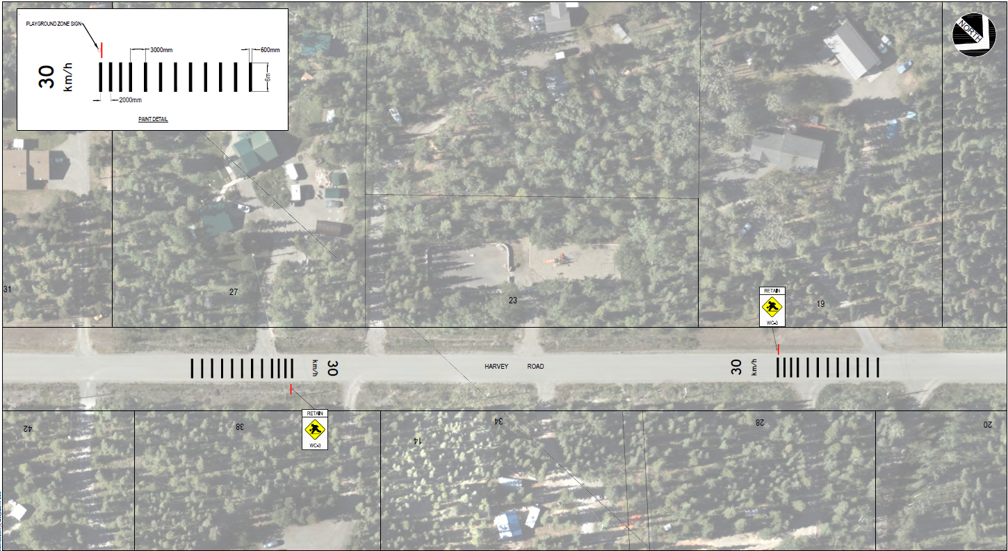
"Watch for pedestrians" will be installed along access roads in country residential neighbourhoods to increase driver awareness and encourage lower speeds.
SEASONAL MEASURES
These measures will be in place starting in June and will be removed before the first snowfall.
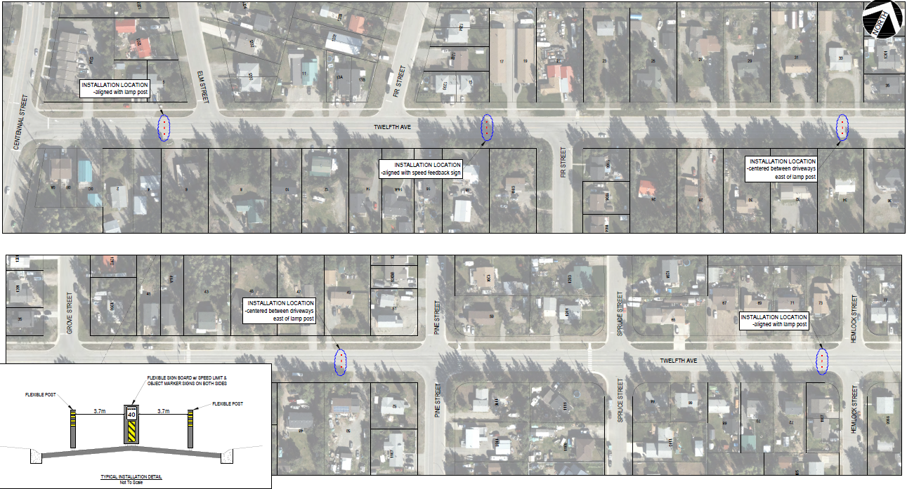
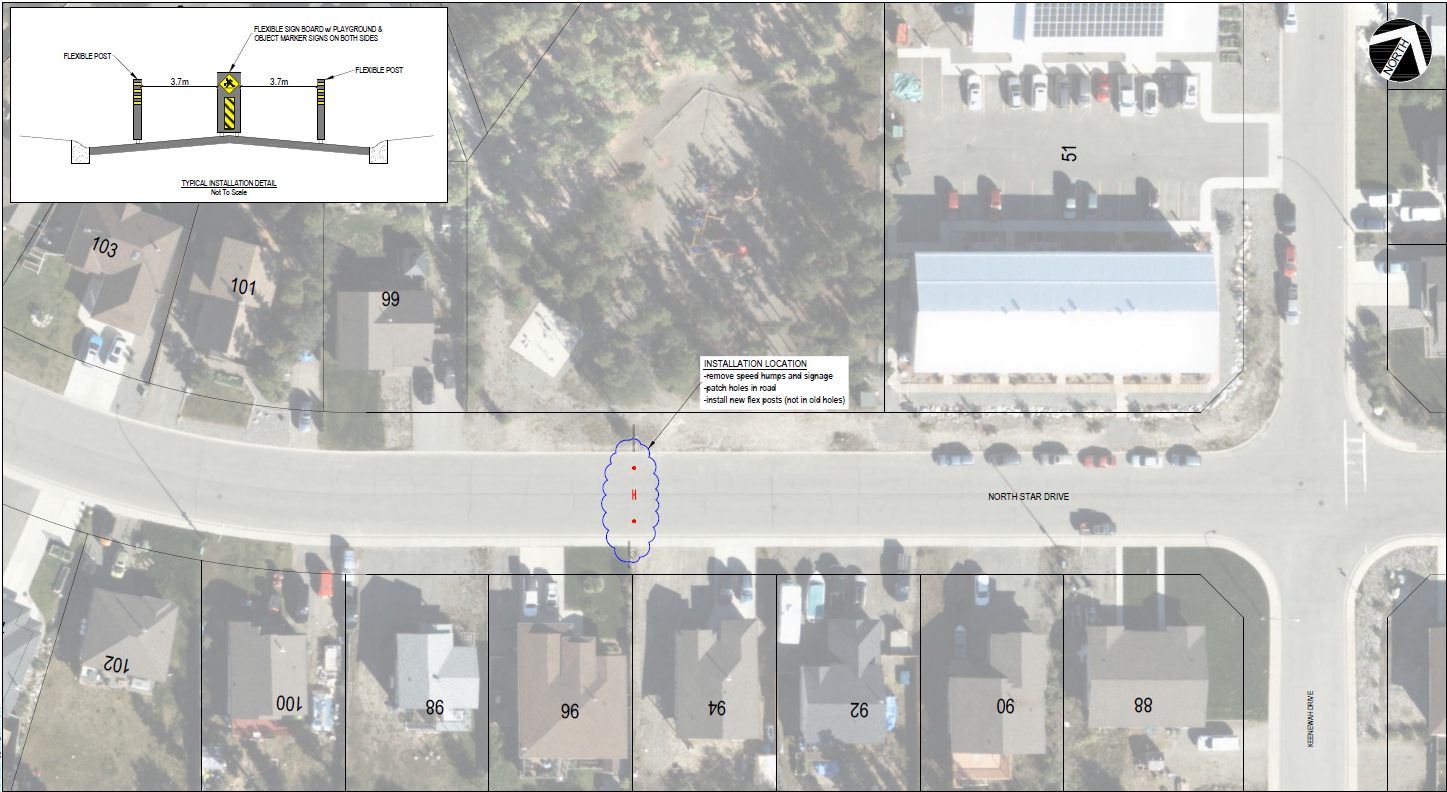
Flexible bollards
These flexible bollards are an effective tool used to narrow the roadway and are implemented across Canada. The installation involves anchors installed in the asphalt that will remain in place over the winter to allow for easier reinstallation the following spring. These measures are expected to return annually.
12th Avenue
Elm, Maple & Oak
Playground zones (North Star Dr and Rainbow Rd)
Kid Alert Sign Distribution
The City is distributing Kid Alert signs you can place in your front yard to remind drivers to slow down and drive safely. Click here to request a Kid Alert Sign for free.
The City has developed a new Traffic Calming Framework that outlines a process for residents to request traffic calming. Requests for traffic calming can be made through a new tool and are evaluated on a yearly basis. Requests received by September 30th of each year will be considered for implementation in the following construction season.
Click here to request traffic calming.
-
Updated Neighbourhood Speed Zones Map
Share Updated Neighbourhood Speed Zones Map on Facebook Share Updated Neighbourhood Speed Zones Map on Twitter Share Updated Neighbourhood Speed Zones Map on Linkedin Email Updated Neighbourhood Speed Zones Map linkThis map indicates the streets where speed limits have been reduced as part of the Neighbourhood Speed Limit Reductions project.
The new reduced speed limits come into effect when new signage is in place. Signs are being installed one neighbourhood at a time. Follow the City of Whitehorse on social media for updates.
You can view an interactive, zoomable map by clicking on the map below.

Documents
-
 Whitehorse Speed Limit Reduction Final Report.pdf (6.04 MB) (pdf)
-
Whitehorse Traffic Calming Report Eugene Avenue Final.pdf (13.3 MB) (pdf)
-
Whitehorse Traffic Calming Report - Normandy Road Final (9.13 MB) (pdf)
-
What We Heard_ Speed Limit Reduction (164 KB) (pdf)
-
What We Heard_ Traffic Calming (246 KB) (pdf)
-
What We Heard_ Traffic Calming Policy (453 KB) (pdf)
-
2024 Neighbourhood Traffic Calming Pilot Project Summary Report (637 KB) (pdf)
-
2023 Neighbourhood Traffic Calming Pilot Project Summary Report (1.75 MB) (pdf)
