Escarpment 2023
Consultation has concluded

As we enter spring, the City is working to plan for this year's snow melt and the 2023 freshet season.
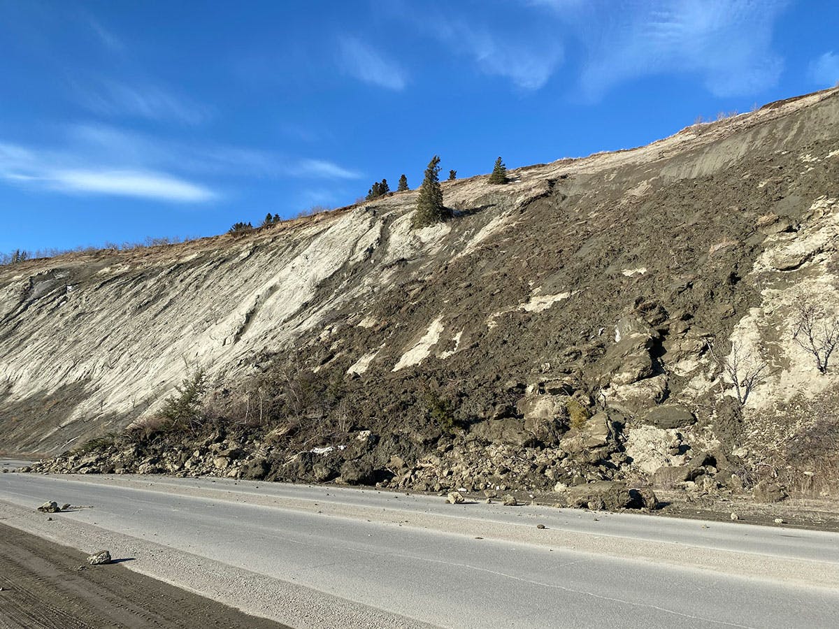
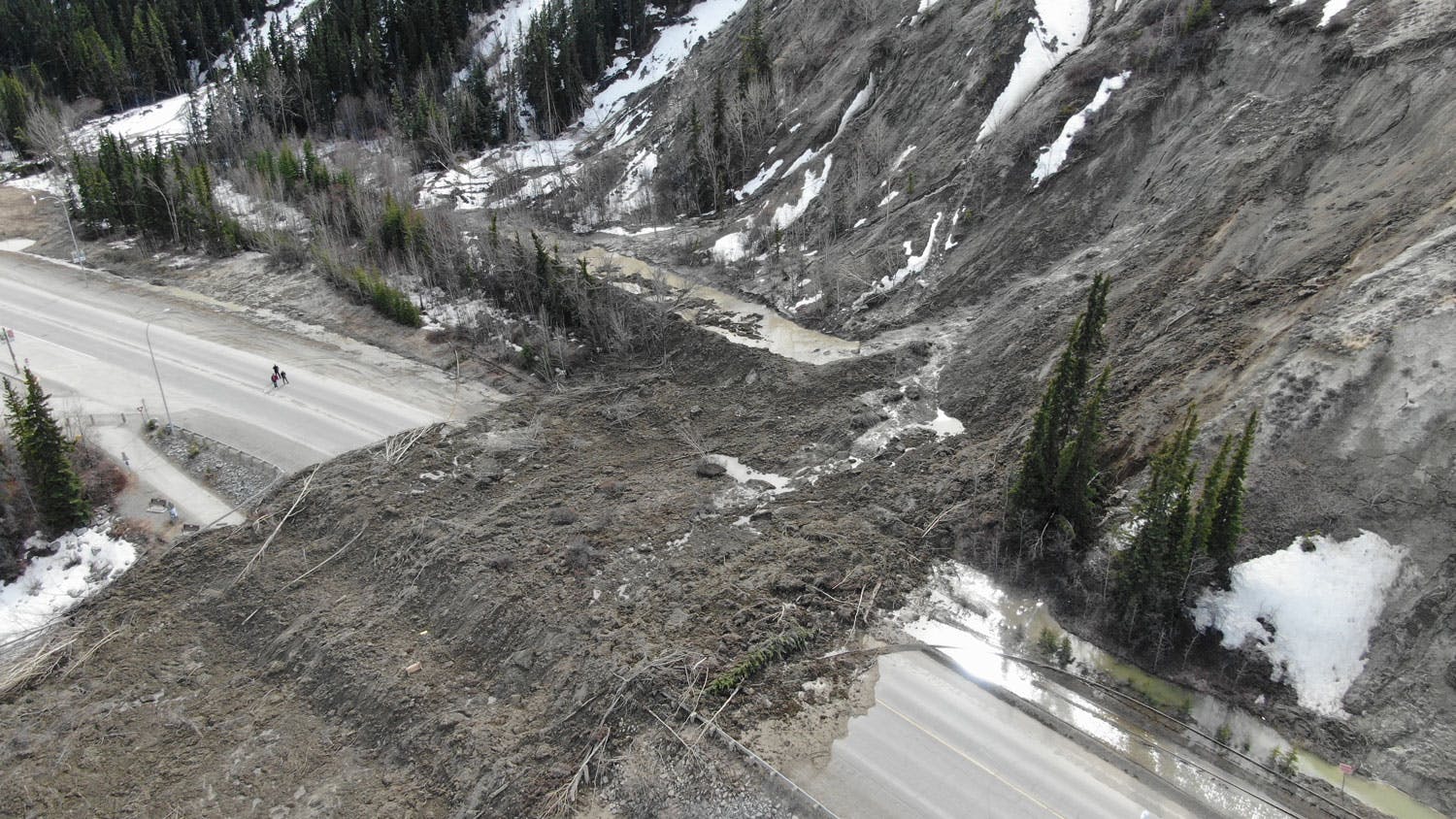
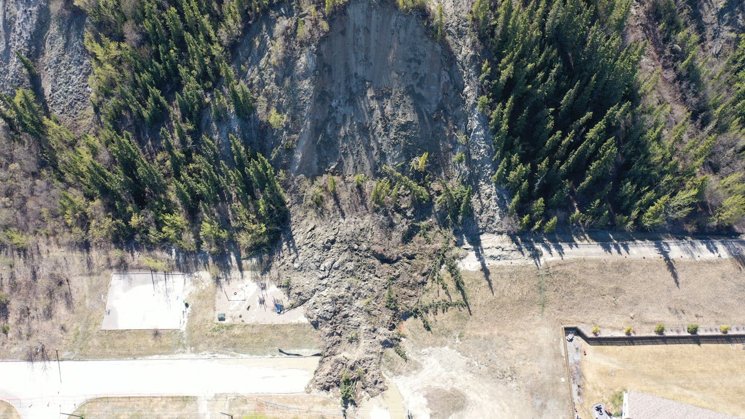
In 2022, a major landslide off the escarpment near Robert Service Way saw the closure of a major traffic artery into the City of Whitehorse. Visit out our FAQs and Glossary.
This year, the City is implementing a comprehensive monitoring program that will build on the work done in recent years, and provide additional data the City can use to develop short, interim and long term plans. Data will be gathered by a variety of methods including: visual inspections, targeted survey monitoring of critical slope areas, drone surveys, and slope monitoring for Robert Service Way.
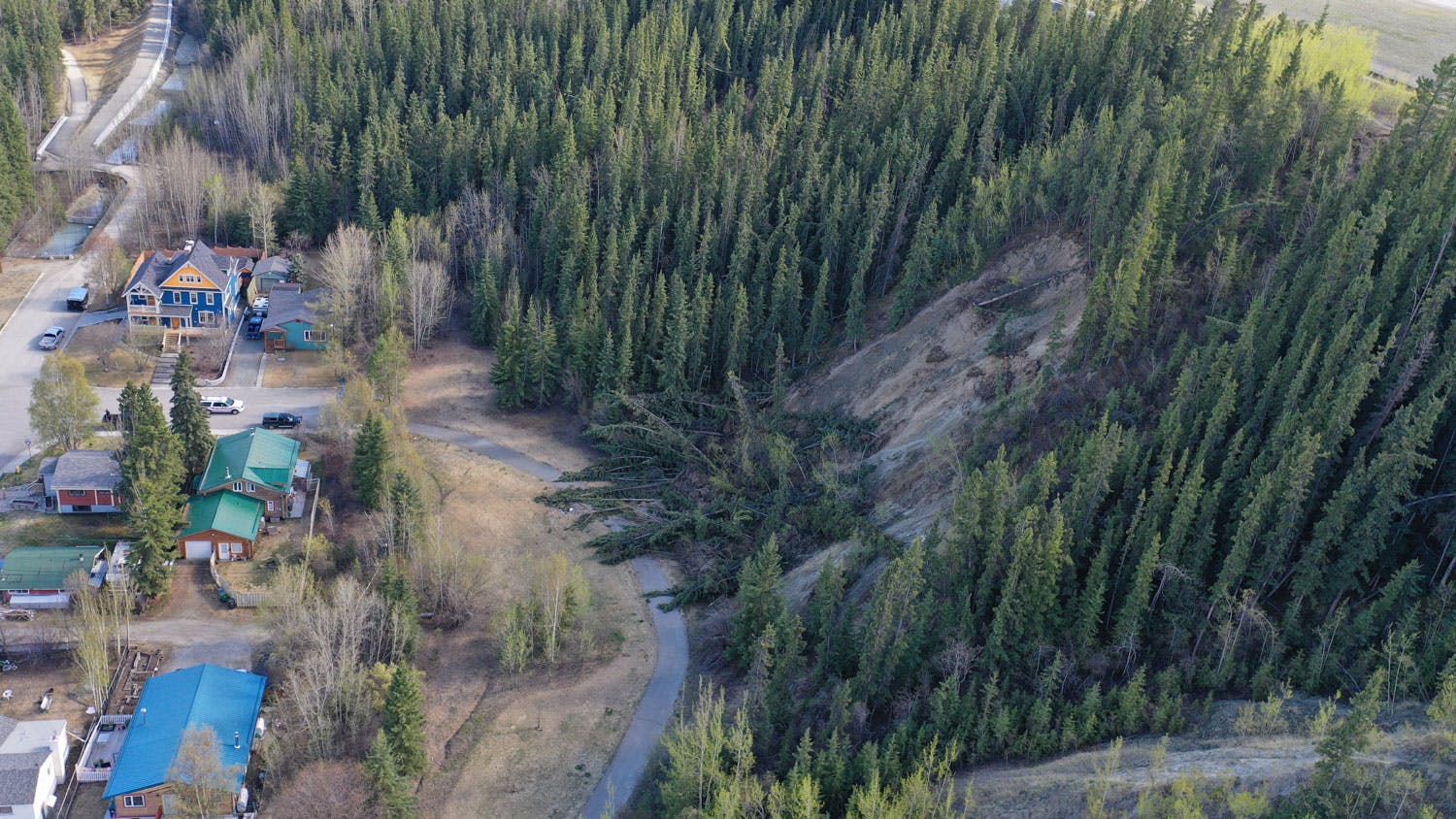
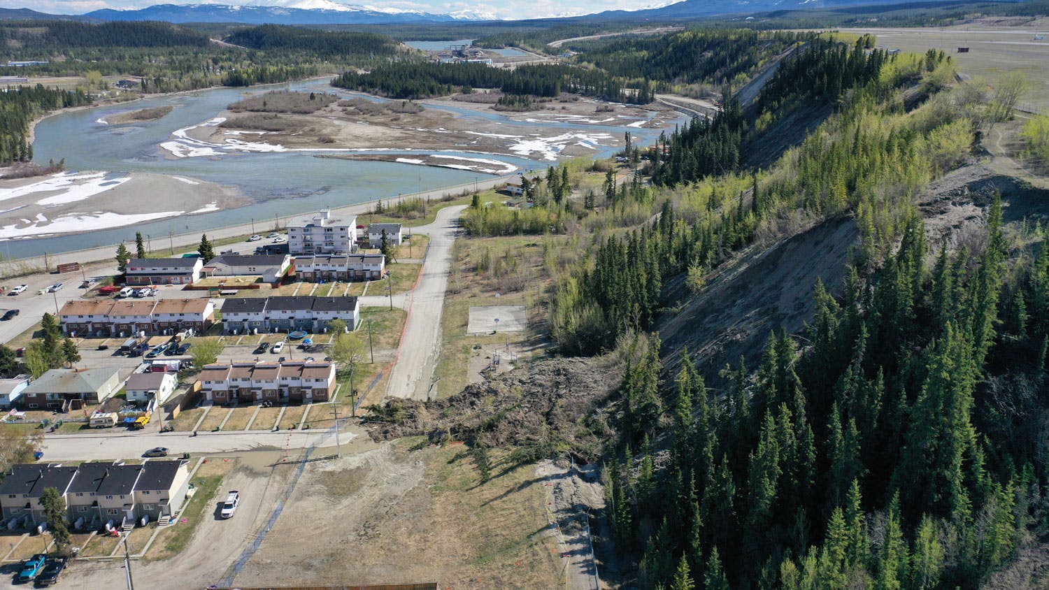
There is a high potential for Robert Service Way, Millennium Trail and other trails along the base of the escarpment to experience partial or full closures during the 2023 freshet if geotechnical engineers recommend closure based on slope conditions. Closing roads and trails through Robert Service Way and along the escarpment is a decision that is not taken lightly. The City understands the impacts of such closures, however the closures may be required to mitigate the risks for the public.
In order to keep residents and visitors informed about the risk of a slide, the City will use a scale to determine what actions it takes to mitigate those risks.
Level 0 – no closures
Level 1 – partial closure of RSW and/or some trails
Level 2 – full closure of RSW and trails
Level 3 – full closure of RSW, trails and potential evacuation of key residents
During this year's freshet season, the City will be using a variety of tools to reach residents and keep them informed. To stay up to date, watch for updates below on this project page, and follow our social media channels on Facebook and Twitter.
Visit out our FAQs and Glossary.

Photos
Videos
-
The escarpment along Robert Service Way continues to show signs of movement at the location of the April 8 slide while the rest of the escarpment is very active.
-
Video taken during a site visit by our Engineering team. They caught this ‘dry slide’ on video as it was happening.
